Article
Leonardo: the retired tamping machine that sees everything
Read more
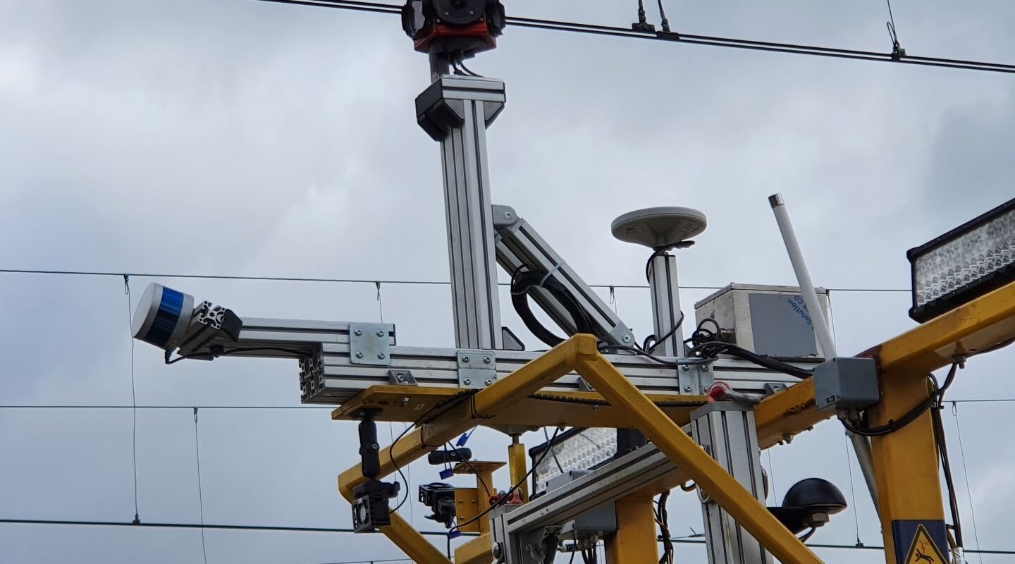
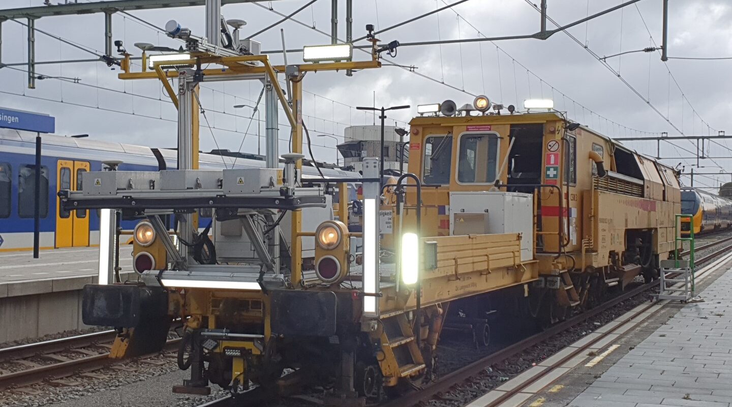
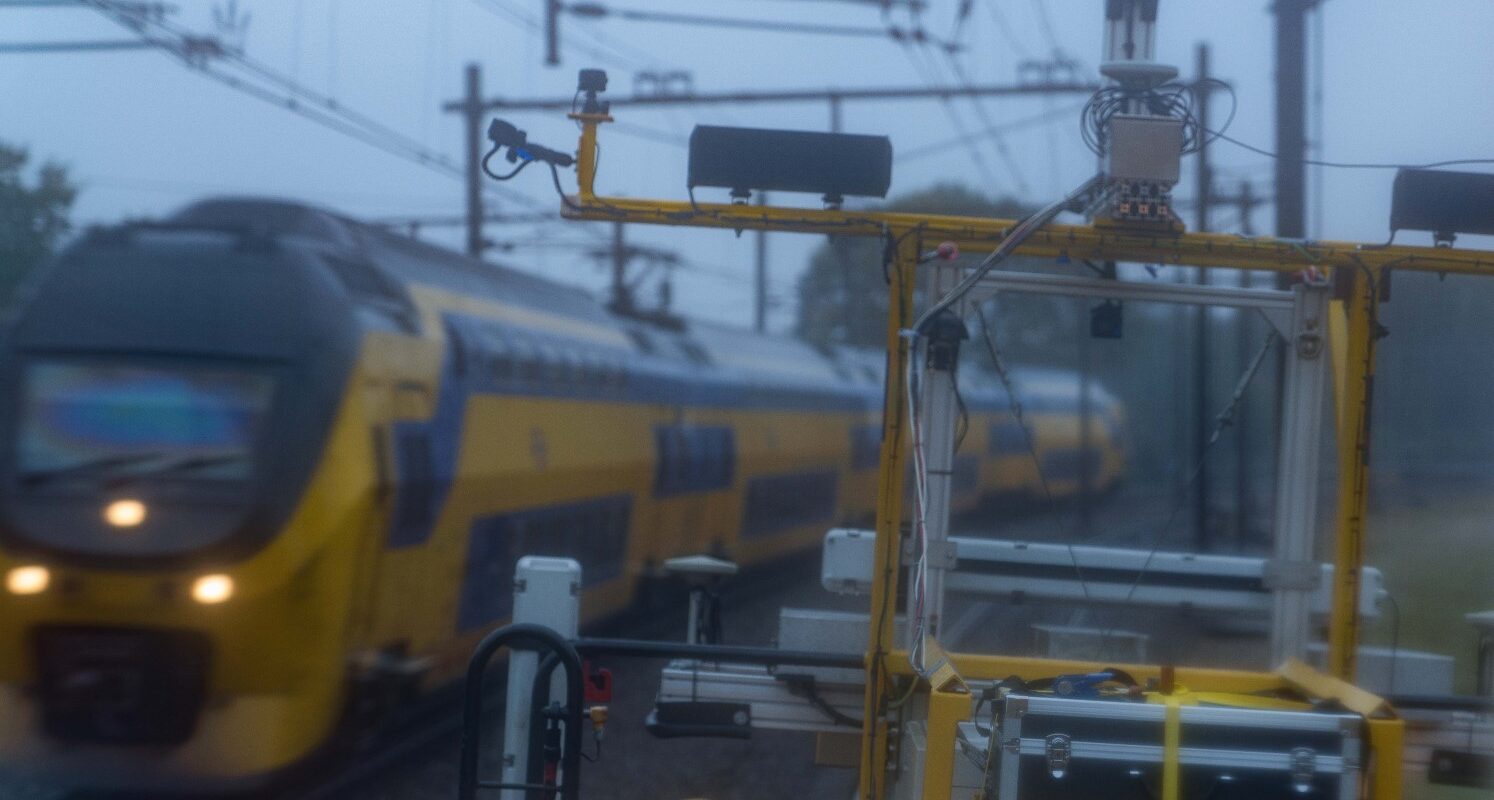
The Leonardo Inspection Train is equipped with an array of cameras, lasers and radar to digitally map the rail infrastructure and its direct surroundings.
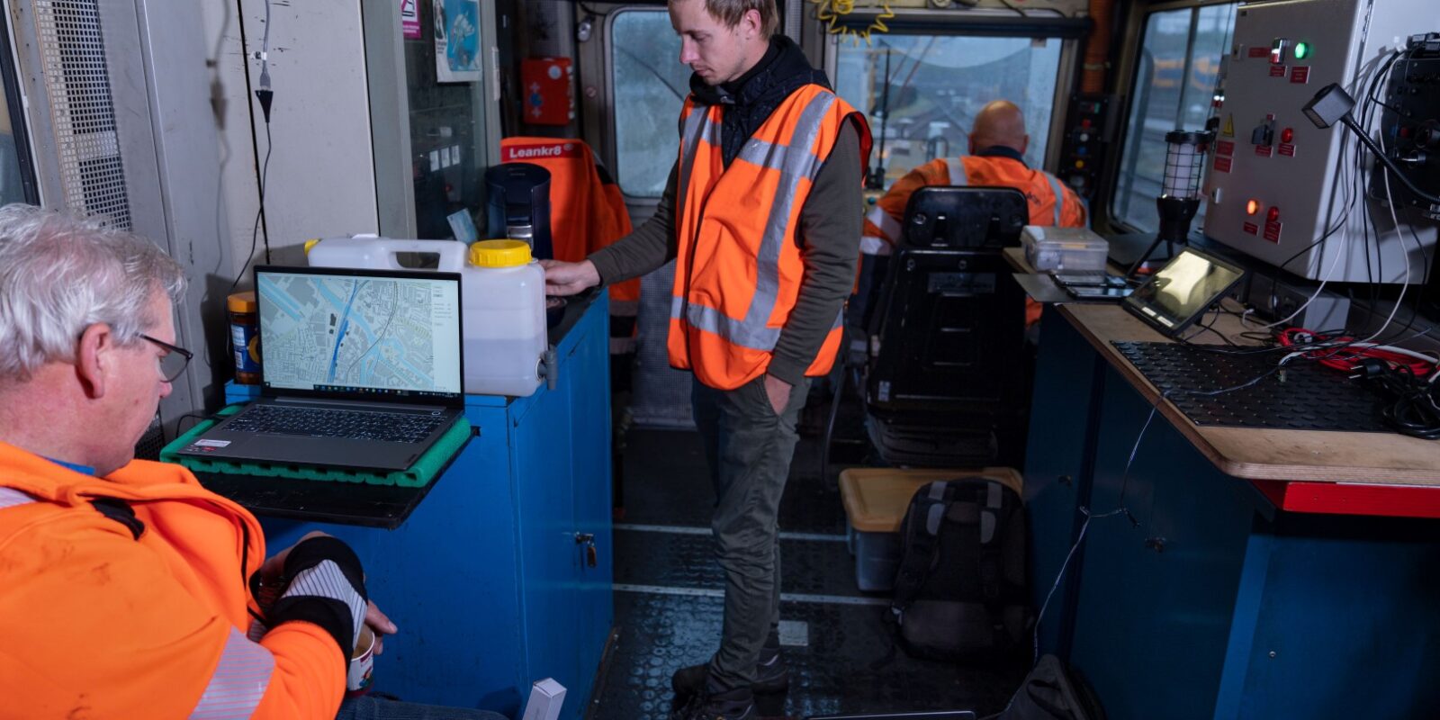
Efficient and effective performance-driven maintenance requires comprehensive knowledge of the condition of the tracks and their surroundings. Acquiring the relevant data can, however, be a time-consuming activity that entails many hours of travelling to and from sites and stringent safety measures. We have developed a smart solution that saves time and effort: the Leonardo Inspection Train. It allows you to digitally check, measure and assess tracks and their surroundings, and then access the data whenever and wherever you need – simply, swiftly, and safely.
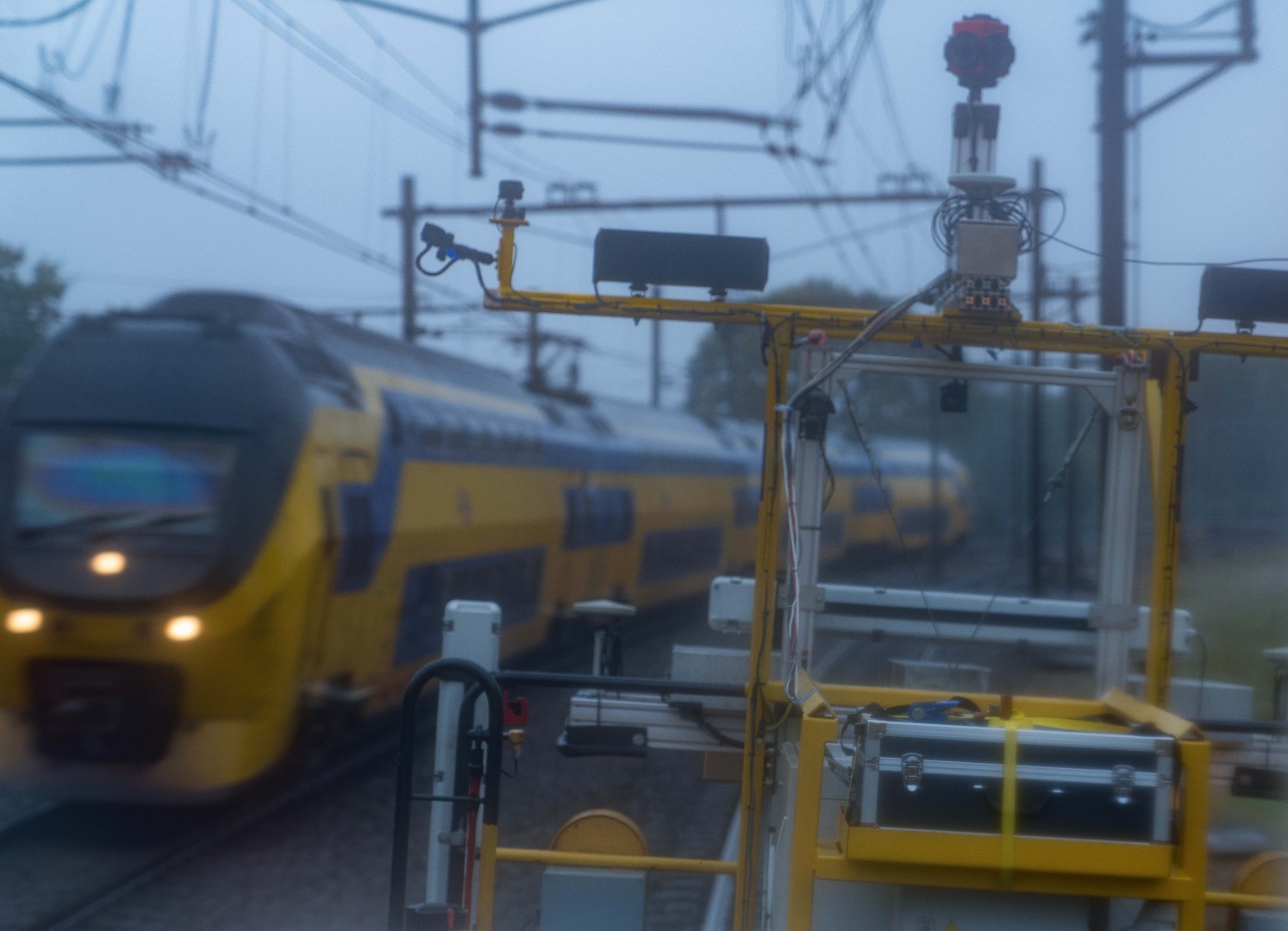
The Leonardo is equipped with an array of cameras, lasers and radar to digitally map the rail infrastructure and its direct surroundings.
The Leonardo Inspection Train is equipped with an array of cameras, lasers and radar to digitally map the rail infrastructure and its direct surroundings. It can operate at a maximum speed of 90 km per hour, thus minimising the impact on scheduled services.
The Leonardo Inspection Train currently includes the following systems:
More systems are set to be included in the near future, to enable the collection of even more data.

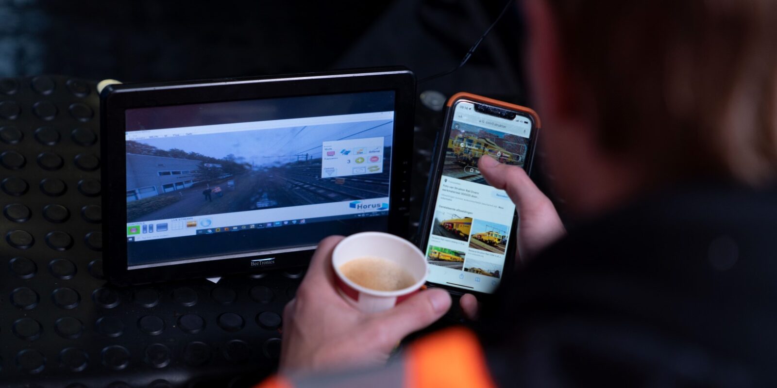
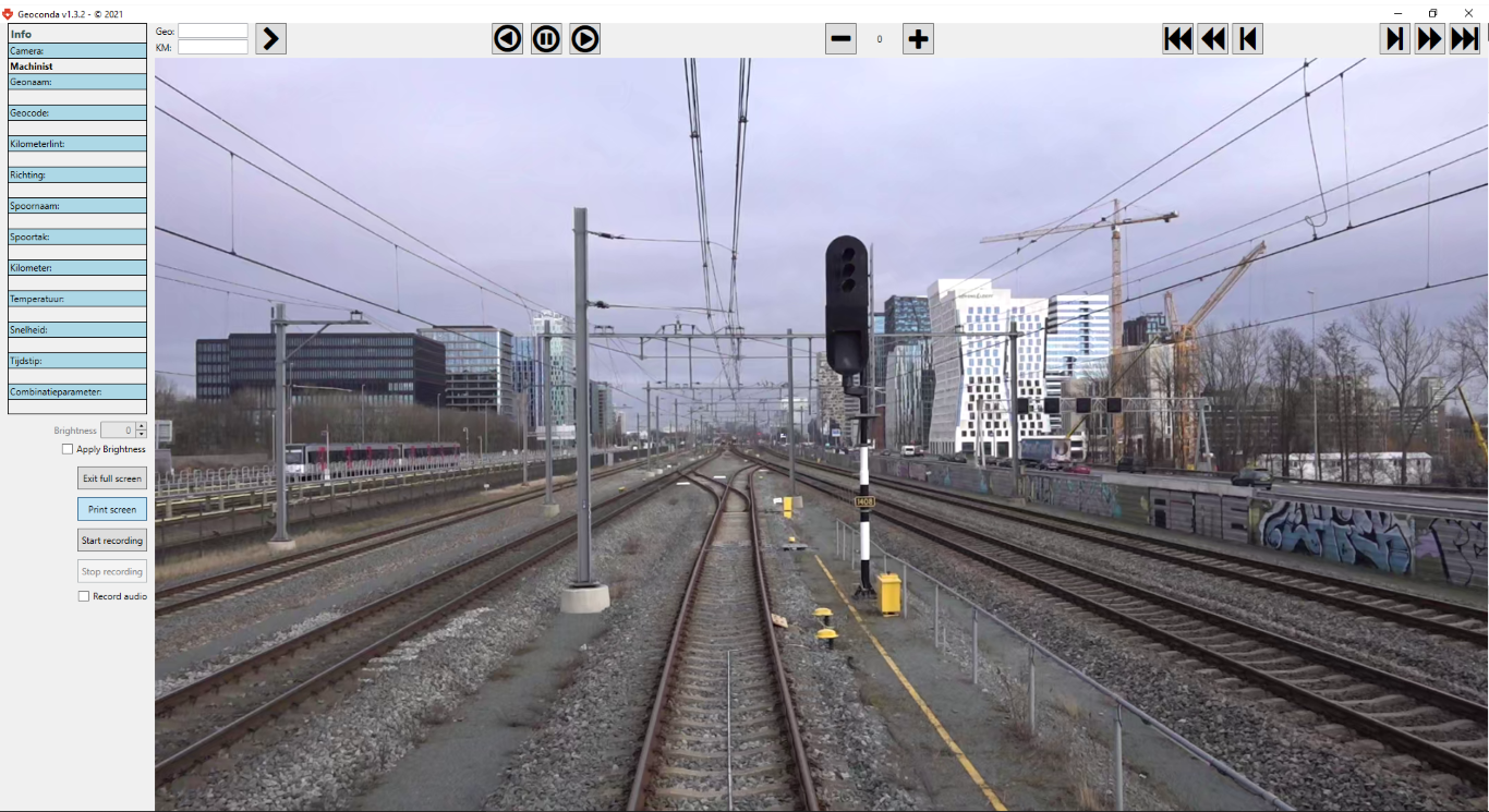
The data collected in this way is enriched with data from other sources, such as asset information, and made accessible for end-users in the Geoconda viewer. Geoconda is a ‘Google Street View for Rail’ and enables you to access and analyse footage of tracks, overhead lines, signalling systems, the verges and signage. Images are stored in an online viewer, for easy and simple access from the comfort of your workspace. To make it easier to find your way around, the Geoconda viewer combines footage, a GIS-map and asset information.
The Strukton Track Scan measures the condition of the tracks
The Strukton Wire Scan measures the condition of the overhead wires