Article
Ground radar shows shocking reality
Read more
Understanding the subsurface with 3D ground radar.
Working in the ground? Planning to carry out excavation work? Check the subsurface first. In the crowded Dutch soil, there may well be concealed cables and pipes. If you unexpectedly hit a cable or pipe, it can damage the underground infrastructure and result in high additional costs, delays and inconvenience to local residents. Fortunately, this is preventable. Before starting the work, you can scan the project area with our 3D ground radar and find out what is hidden under the ground.
We suspend our ground radar under an electric squad or handcart. This is how we sustainably map the subsurface. For our own inspections in the rail sector, we also attach it to the Leonardo inspection train.
Below you can read about a number of ways in which 3D ground radar is used.
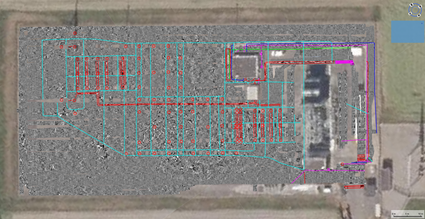
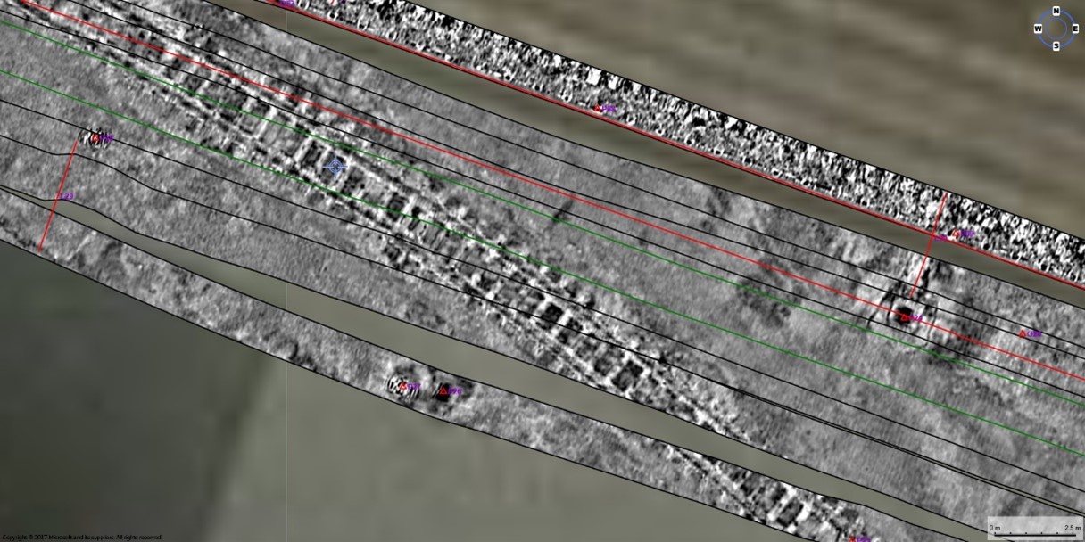
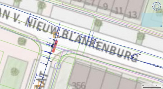
Verify known location data and accurately record the actual location of cables and pipelines, including their current depth (coverage assessment). Unidentified cables/pipes are also often encountered under the ground. Ground radar surveys can greatly reduce the number of trial trenches that are required.
Example of radar data interpretation (blue) on KLIC soil
While projects are being planned and executed, Building Information Models (BIM) are often used to create and manage important spatial information. Information about the subsurface is often missing. The use of 3D radar gives you an extra underground dimension in the model that enables you to optimise the planning and execution of your project (such as clash detection, determining the available free space, etc.). We can also carry out above-ground 3D scans. If required, all the available data (the current and future situation) can be made transparent or processed into a digital twin using AR applications.
Underground cavities can cause subsidence and damage to roads and dykes, for example. Ground radar makes it possible to detect (incipient) cavities. These cavities can be caused by leaching or animal burrowing (badgers, beavers, voles, etc.) but also crack formation due to damage and/or drought.
Example of a detected foxhole
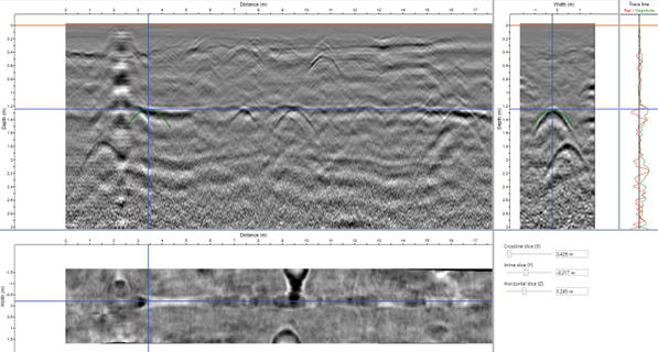
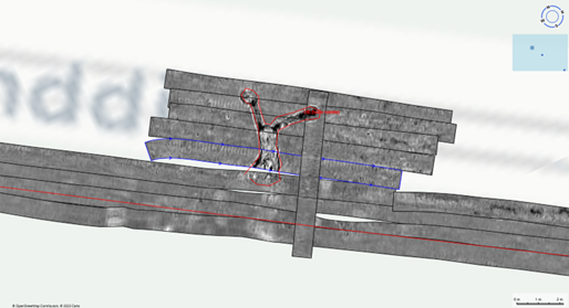
Remnants of former buildings (foundation remnants, piles, cellars, underground tanks, etc.) are often found in the subsoil. In some cases, these remnants have archaeological value. 3D radar can be used to comprehensively survey a terrain for underground objects/obstacles.
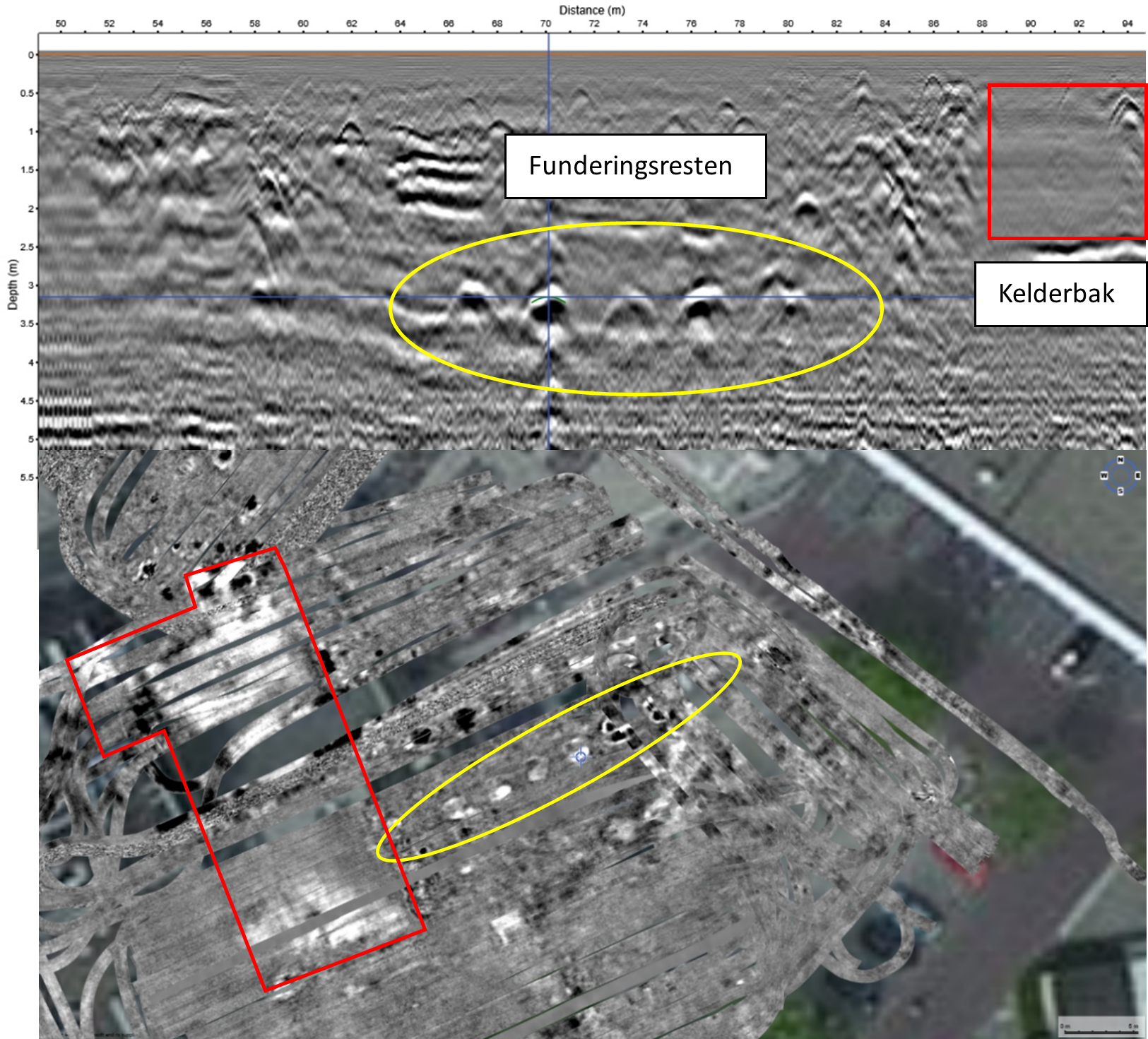
Example of a comprehensive radar scan of a vacant lot with obstacles in the subsurface. A = depth profile in scanning direction, B = overhead view of depth cross-section at approx. 3 m-mv.
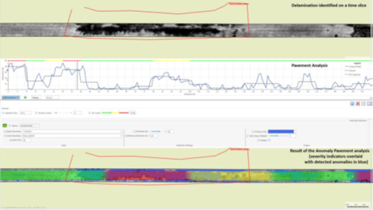
We can use ground radar to ‘screen’ engineering structures. This gives us an insight into the condition of the structure. Examples include measuring the thickness of concrete layers, screening the reinforcement grid and prestressing in a concrete layer, assessing whether the reinforcement is corroded, detecting crack formation, delamination or moisture penetration, etc.
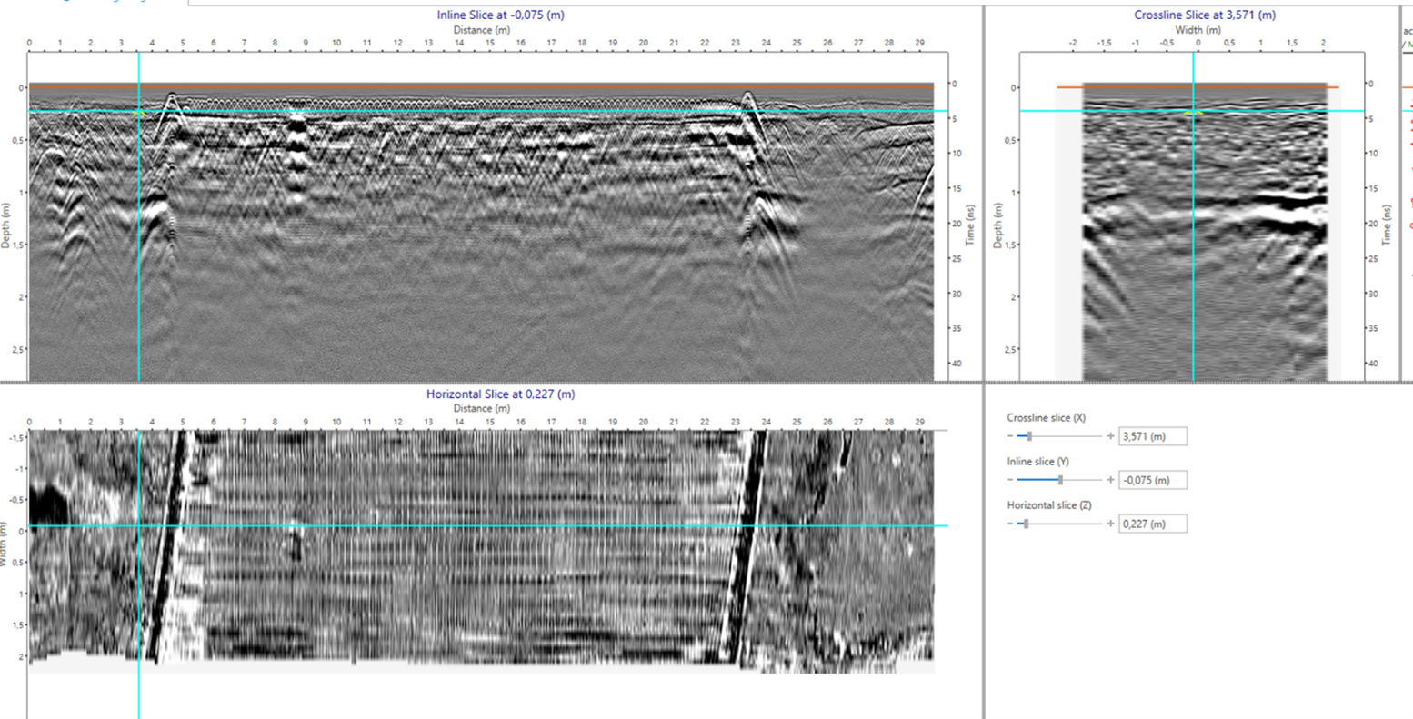
Example of comprehensive radar scan of a bridge deck with visible paving layer, concrete layer with reinforcement, baffle plates, etc.
Ground radar can be used to determine the layer structure in soil and asphalt layers. Then you can comprehensively map the thickness and layer structure of asphalt paving (and, where necessary, the underlying foundation layer). This gives you a more accurate idea of the released volumes. But ground radar can also detect crack formation, delamination and leaching. An additional advantage is that during the same operation you can scan the subsoil under the paving layer (for manholes, cables/pipes, cavities, etc.).